 separate from the United States). Even Hawaii and Alaska are often taken out of their original geographic position and placed in the middle of the Atlantic ocean right off the coast of California (or this great example to the right, where Alaska is actually in Mexico); it doesn't matter that this is geographically incorrect because it is not about maps based in reality, but a symbol of the national geobody.
In the case of China, most history and geography textbooks argued that China has been a cohesive unified unit since the Qin dynasty (221 BC), and the emperor who began this dynasty was considered the "unifier of China." In fact, the name used for this emperor, Qinshihuang, literally means the first emperor of China, indicating a specific time when China was unified. However, to argue that from 221BC onwards the people of "China" had a clear image of a unified geobody is anachronistic; they knew they had a single head of state, but the concept of "nation" was not something we saw until the 20th century, and indeed was not even widely propagated until the 1920s and 1930s, mainly through the textbooks which Culp uses as his main source (and the sources I plan to use as well).
However, there seemed to be a pretty standard map for this imagined geobody which demonstrated the nation "China," a map that, like those of our 50 states, was depicted to students separate and sovereign . The "China" that was considered the modern nation was based upon the boundaries of the last decade of the Qing dynasty (1900-1911), thus including territories such as Xinjiang, Tibet, Mongolia, and Manchuria. This geographical unit was depicted as a timeless entity, a bounded nation dating back 2000 years, when really the nationalist government had very little control or influence in many of these western territories.
Culp also talks about the narratives of territories "lost" and territories that must be "regained," a narrative that was anti-imperialistic in nature. He includes a map titled "China's map of humiliation" which shows the pieces of the Chinese empire lost through a series of humiliating battles, such as Hong Kong to Britain, Korea and Taiwan to Japan, and parts of Burma and Nepal to Britain and France. I found a map that is not quite the same, but shows a similar
 theme; it shows a map of China from the Qing which includes Korea and parts of Southeast Asia, but also shows territory ceded to the British. The common metaphor was to compare the Chinese geographical entity to a mulberry leaf which was continuously being nibbled away; another common one was a melon that outside powers were "carving away." These metaphors were important because they not only gave Chinese students a tangible entity with which they could associate the nation, but also legitimized further governmental control over and migration to these western territories that needed to be either regained or protected. However, the territories that were "lost" and those that were to be regained didn't exactly correspond; it was considered a humiliation that China lost its sovereignty and control over Vietnam, Korea, and Afghanistan, but it was not considered imperative that they be reclaimed, whereas Mongolia, Hong Kong, Taiwan, and after 1931 Manchuria were part of the Chinese geobody.
Culp points out this disparity in territories lost and territories that should be regained, but does not give a sufficient
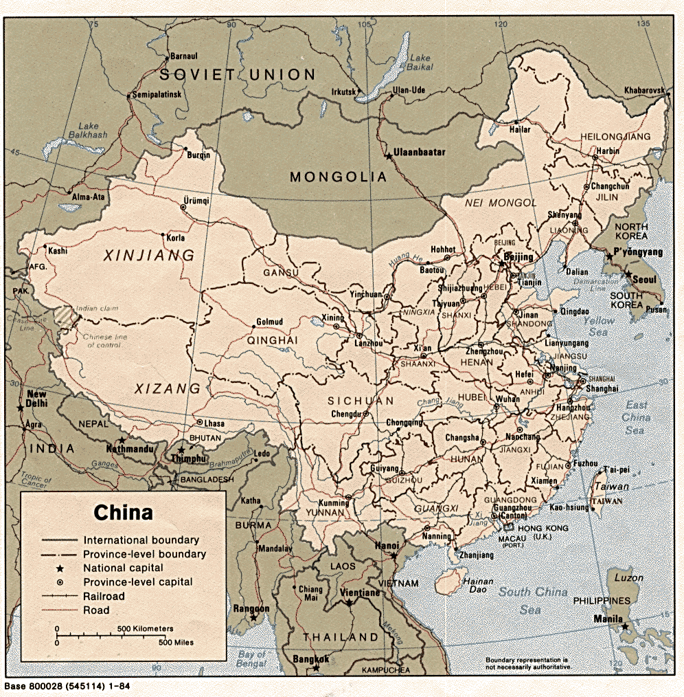 answer as to why some territories were considered permanently lost and others were not. He claims that the borders from the last decade of the Qing (see map to left) were standard for the Chinese geobody, (which, as he points out, is quite optimistic; much of this territory was only fleetingly "under Chinese control" and had very little connection with the newly formed nation); however, why was Burma permanently lost, but Tibet was necessarily part of the Chinese state (regardless of the fact that it, like parts of Xinjiang and Mongolia, had declared independence)? This to me is a crucial question; how, when, and why exactly was this particular border decided, and was it as uniformly standard in education as Culp makes it out to be?
This is not only important for understanding the origins of Chinese geographical nationalism, but also for understanding Chinese nationalism today. This narrative, and indeed this geobody, exists today. Many of us don't understand why Chinese people still consider Tibet and Taiwan part of their country; the roots are here. This imagined geobody, regardless of the fact that it is mainly idealized by nationalists and not really based in a real imagined community (i.e., many Tibetans do not feel a strong sense of Chinese nationalism), is the geobody that Chinese students are taught today. This is especially crucial now as the international community threatens the Chinese image of their nation, and the Chinese government may end up cracking under the pressure and will thus have to change their geographical symbolic nation.
It also allows us to look at our own image of our "nation." Take for instance, a map of the 13 colonies; this is never in history textbooks labeled a "map of America," but instead a map of the 13 colonies.
 Furthermore, maps of the United States before all 50 states were formed is still placed in the goegraphical entity of the US (see "emerging nation" map to right). Ultimately, a map of the US that does not include this geographical territory is inchoate, it is not the United States that we associate with our nationalism. We can also ask the question, then: does our textbooks point to a political platform that favors a federal government over states rights? It has been a common argument throughout our history; it is interesting to note that through images of a geobody we are taught to imagine a unified America, one in which the nation supersedes states.
As I delve into my research, I hope to return to the question of the origins of this particular geobody, as I think it will illuminate a major source of national identity in the hearts of Chinese people in the 1930s and today.
Sources:
Culp, Robert. Articulating Citizenship: Civic Education and Student Politics in Southeastern China, 1912-1940. Cambridge: Harvard University Press, 2007.
"Map of an Emerging Nation." US Geological Survey. http://education.usgs.gov/common/lessons/images/emerg_1810.jpg
"Map of China." http://gyemo.files.wordpress.com/2008/04/dynasty-qing-s1.jpg
"Map of China." History of China. http://www-chaos.umd.edu/history/chinamap.gif
"USA Map" Maps of the World . http://www.mapsofworld.com/usa/usa-maps/world-map-usa-political-enlarge-view.gif

No comments:
Post a Comment